Self-Paced Lesson
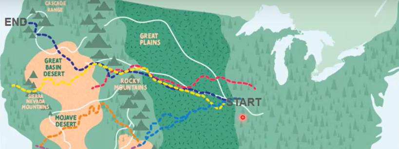
Using a map and a key, students will learn about several overland trails that people living in the United States traveled along in the mid-1800s while migrating across the country to the western regions of the United States. They will also learn about the geographical features that these trails crossed. Students will then be given the opportunity to create their own maps and keys.
Standards
CA HSS 4.3.2
CA HSS 5.8.2
CA HSS 5.8.4
Lesson Resources
Lesson: Pdf in full; Pdf in Spanish
Student Response Sheet: Student Response Sheet (fill-able pdf); Student Response Sheet (fillable pdf) in Spanish
Teaching Tips for Different Learning Environments
Whole Class In-Person Learning:
- Read the INTRODUCTION and PART I together with the whole class while referring to the map and the key. Then ask the students to complete the matching activity in pairs before reviewing their answers with the whole class.
- Read PART 2 together with the whole class while referring to the map and the key. Then ask the students to answer the questions in pairs before reviewing their answers with the whole class.
- Read PART 3 together with the whole class. Ask students to share their favorite places that they would like to make maps of. Then show some examples of what these different types of maps might look like. Assign PART 3, PART 4, and PART 5 for students to complete individually.
- Have students share PART 4 and PART 5 with the whole class during a gallery walk.
Whole Class Distance Learning: Please see the instructions for Whole Class In-Person Learning. Instead of having the students share PART 4 and PART 5 with the whole class during a gallery walk, the students can post PART 4 and PART 5 on Padlet or post a video of themselves sharing PART 4 and PART 5 through Flipgrid.
Associated Resources
Educational Video: Six Trails West Video
Lesson: Six Trails West
Lesson: Westward Expansion Art


